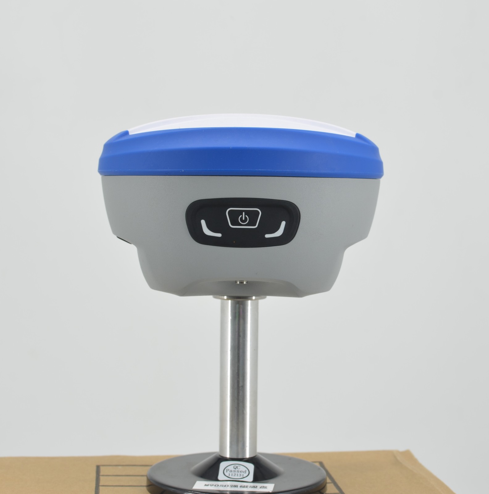
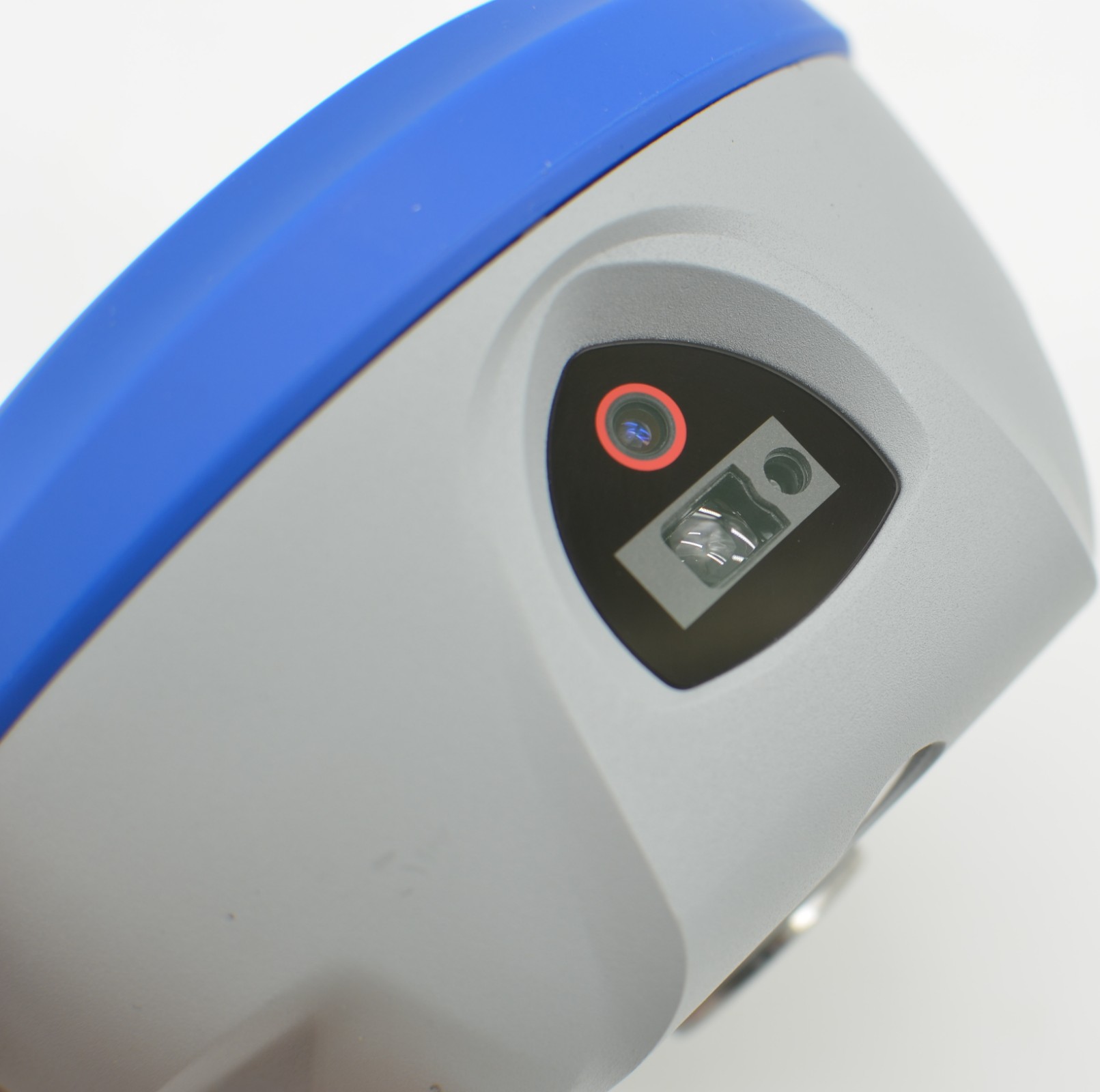

This intelligent GNSS receiver is powered by a Linux + ARM Cortex-A7 platform and distinguishes itself with a Non-Contact Laser Measurement module, allowing precise, prism-free capture of hard-to-reach points. It integrates an IMU to eliminate "fly points" through real-time tilt compensation and utilizes an ultra-wide-angle camera for intuitive AR Real-Time Stakeout. Housed in a rugged Magnesium Alloy body with IP68 protection, it supports comprehensive connectivity (4G/WiFi/Radio) and ensures long-term endurance for professional surveying.
The DADI DG95 PRO is a revolutionary GNSS receiver that integrates Laser Measurement technology with a powerful Linux + ARM Cortex-A7 smart system. It delivers centimeter-level positioning and supports all major constellations (BDS, GPS, GLONASS, Galileo, QZSS, NavIC, and SBAS).
Engineered for versatility, it features dual cameras for AR Stakeout and Laser Measurement, along with IMU tilt compensation (<2cm within 60°) and a complete data link, making it the ultimate tool for high-precision, contactless surveying.

Linux Smart System
Powered by a Linux + ARM Cortex-A7 intelligent platform, offering efficient computation and unlimited product functionality expansion.
Non-Contact Laser Measurement
Equipped with a high-precision millimeter-level laser ranging module, allowing for safe and precise measurement of hard-to-reach points without a prism pole.
Tilt Measurement & AR Stakeout
Built-in IMU eliminates "fly points" with real-time tilt compensation. AR real-time stakeout utilizes a professional ultra-wide-angle camera for accurate visual guidance.
Full Connectivity & Robust Design
Supports 4G, WiFi, Bluetooth, and internal radio. Encased in a rugged magnesium alloy body with IP68 protection and a high-capacity battery for long endurance.

| Hardware & System | |
| Hardware Platform | ARM Cortex-A7 |
| Operating System | Linux |
| Channels | 1408 |
| GNSS Configuration | |
| GPS | L1 C/A, L1C, L2P(Y), L2C, L5 |
| BDS | B1I, B2I, B3I, B1C, B2a, B2b |
| GLONASS | L1, L2, L3 |
| GALILEO | E1, E5a, E5b, E6 |
| QZSS | L1, L2, L5 |
| SBAS / NavIC | L1 / L5 |
| Standard Output | NMEA-0183 |
| Correction Protocol | RTCM3.X |
| Frequency | 20Hz |
| Initialization Time | <10s (Reacquisition <1s / Cold Start <40s) |
| Internal Noise | <1mm |
| Phase Center Offset | <2.5mm |
| Accuracy Performance | |
| Single (RMS) | Horizontal: 1.5m / Vertical: 2.5m |
| DGPS (RMS) | Horizontal: 0.4m / Vertical: 0.8m |
| RTK (RMS) | Horizontal: ±(8mm+1ppm) / Vertical: ±(15mm+1ppm) |
| Static Mode (RMS) | Horizontal: ±(2.5mm+1ppm) / Vertical: ±(5mm+1ppm) |
| Tilt Correction | <2cm (Within 60°) |
| AR Stakeout Accuracy | Horizontal: ±(8mm+1ppm) / Vertical: ±(15mm+1ppm) |
| Laser Measurement | 3D accuracy within 5m: ≤ 2.5cm |
| Timing / Velocity | 20ns / 0.03m/s |
| System & Connectivity | |
| Bluetooth | BR+EDR+BLE |
| NFC / WIFI | Support / 802.11 b/g/n/ac |
| Network | LTE FDD: B1/2/3/4/5/7/8/12/13/18/19/20/25/26/28 LTE TDD: B38/39/40/41 WCDMA: B1/2/4/5/6/8/19; GSM: B2/3/5/8 |
| Radio | Integrated transceiver (410-470MHz) Power: 0.5W/1.5W Protocols: TRIMTALK, TRIMMK3, SOUTH, TRANSEOT, SATEL, LORA Baud: 4800, 9600, 19200 |
| Storage | 8GB (Voice Support) |
| Cameras | |
| Laser Camera | 1/3.06 inch, f/2.9 Res: 4224*3200 FOV: D44° H=35° V=26.5° Distortion: <1% |
| AR Camera | 1/2.8 inch, f/2.5 Res: 1920*1080 FOV: 69.3°±3° Distortion: <0.38% |
| Environmental & Physical | |
| Battery | 7.4V, 6500mAh (2P2S) |
| Work Time | > 16 hours (Typical, Rover, GSM) |
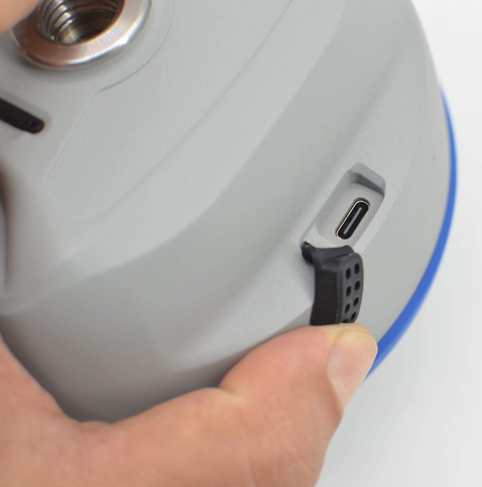
| Charge | USB PD 15V/2A, 5V/3A |
| Temperature | Operating: -25°C~+60°C / Storage: -40°C~+85°C |
| Protection | IP68 (1.5m drop resistance) |
| Dimensions / Weight | 134mm*86mm / ≤0.78Kg |
| Materials | Magnesium alloy casing with ABS/PC top |
| Accessories | DG95 Pro, USB Adapter, Type-C Cable, Antenna, Controller |
The DG95 PRO features a high-resolution Laser Camera that enables non-contact measurement of points up to 5 meters away with high accuracy (≤2.5cm), ideal for inaccessible areas.
Yes, it utilizes a dedicated 1080P AR Camera to provide a real-world visual overlay on your controller, guiding you directly to your stakeout points.
It is a full-constellation receiver supporting GPS, BDS, GLONASS, GALILEO, QZSS, SBAS, and NavIC signals, ensuring robust performance worldwide.


Contact our customer support
team 7×24 hours
WhatsApp:+86-+86 18915003276