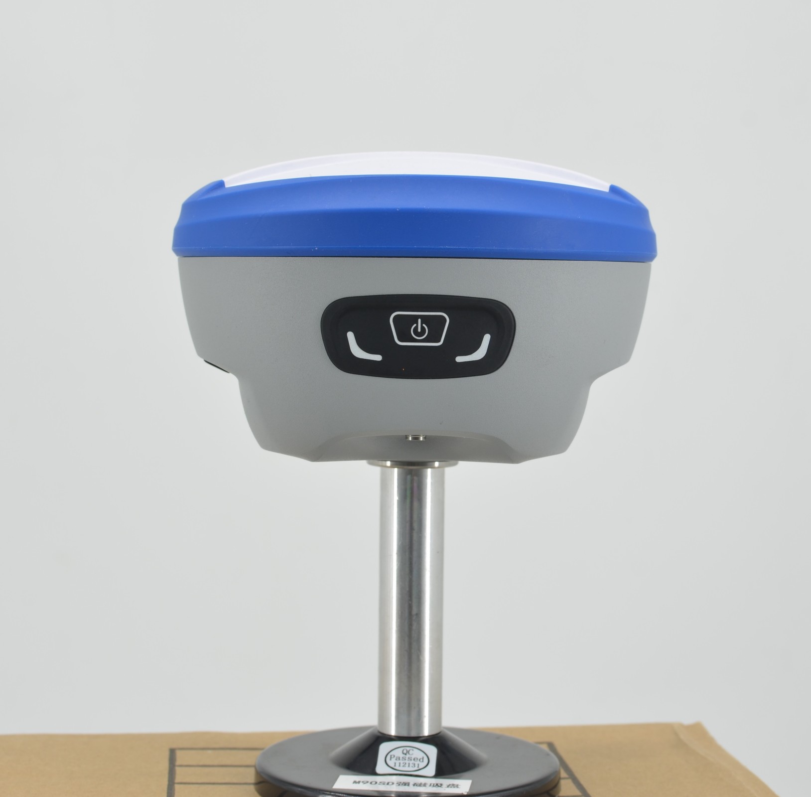
This intelligent GNSS receiver combines a high-performance Linux + ARM Cortex-A7 platform with Full Constellation Support (including NavIC and SBAS) to ensure reliable tracking in any environment. It redefines efficiency with Calibration-free IMU tilt measurement (<2cm accuracy at 60°) and AR Real-Time Stakeout, which visualizes targets via the built-in camera for intuitive guidance. Featuring Comprehensive Connectivity (4G/WIFI/Radio) and a Rugged IP68 design with high-capacity battery life, it is the ultimate tool for precise, all-day surveying operations.
The DADI DG95 is a smart GNSS receiver powered by a Linux + ARM Cortex-A7 system. It integrates a high-precision positioning module that supports all major satellite constellations (BDS, GPS, GLONASS, Galileo, QZSS, NavIC, and SBAS).
Designed for efficiency, it features Centimeter-level positioning, high-precision IMU tilt measurement (<2cm within 60°), and AR real-time stakeout. With a complete data link (4G/BT/WIFI/Radio) and IP68 protection, it is built for reliable, flexible fieldwork.

Linux Smart System
Powered by a Linux + ARM Cortex-A7 intelligent platform, offering efficient computation and expandability.
Full Constellation Support
Supports BDS, GPS, GLONASS, Galileo, QZSS, NavIC (IRNSS), and SBAS for robust signal tracking in any environment.
High-Precision Tilt Measurement
Calibration-free IMU tilt measurement achieves accuracy of less than 2cm within a 60° tilt range.
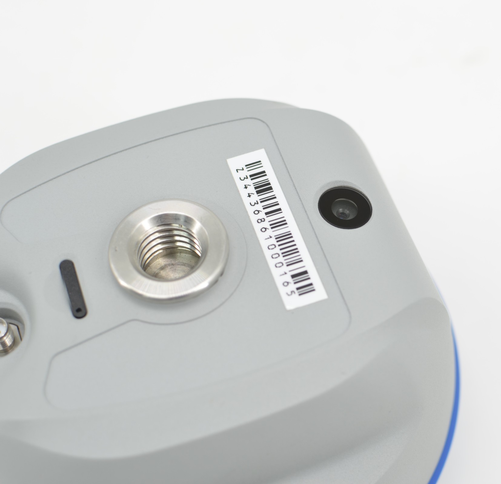
AR Real-Time Stakeout
Visualizes stakeout points in real-time on the controller using the built-in AR camera for intuitive guidance.
Comprehensive Connectivity
Features a complete data link with support for 4G, Bluetooth, WIFI, and internal Radio for flexible working modes.
Robust Design & Endurance
Equipped with a high-capacity lithium battery for long endurance and meets IP68 standards for safety and reliability.

| Hardware System | |
| Hardware Platform | ARM Cortex-A7 |
| Operating System | Linux |
| Channels | 1408 |
| GNSS Signals | |
| GPS | L1 C/A, L1C, L2P(Y), L2C, L5 |
| BDS | B1I, B2I, B3I, B1C, B2a, B2b |
| GLONASS | L1, L2, L3 |
| GALILEO | E1, E5a, E5b, E6 |
| QZSS | L1, L2, L5 |
| SBAS / NavIC | L1 / L5 |
| Standard Output | NMEA-0183 |
| Correction Protocol | RTCM3.X |
| Frequency | 20Hz |
| Initialization Time | <10s (Reacquisition <1s / Cold Start <40s) |
| Internal Noise | <1mm |
| Phase Center Offset | <2.5mm |
| Accuracy Performance | |
| Single (RMS) | Horizontal: 1.5m / Vertical: 2.5m |
| DGPS (RMS) | Horizontal: 0.4m / Vertical: 0.8m |
| RTK (RMS) | Horizontal: ±(8mm+1ppm) / Vertical: ±(15mm+1ppm) |
| Static Mode (RMS) | Horizontal: ±(2.5mm+1ppm) / Vertical: ±(5mm+1ppm) |
| Timing Precision | 20ns |
| Velocity Estimation | 0.03m/s |
| Tilt Correction | <2cm (Within 60°) |
| AR Stakeout Accuracy | Horizontal: ±(8mm+1ppm) / Vertical: ±(15mm+1ppm) |
| System & Connectivity | |
| Bluetooth | BR+EDR+BLE |
| NFC / WIFI | Support / 802.11 b/g/n/ac |
| Network | LTE FDD: B1/2/3/4/5/7/8/12/13/18/19/20/25/26/28 LTE TDD: B38/39/40/41 WCDMA: B1/2/4/5/6/8/19; GSM: B2/3/5/8 |
| Radio | Integrated transceiver (410-470MHz) Power: 0.5W/1.5W Protocols: TRIMTALK, TRIMMK3, SOUTH, TRANSEOT, SATEL, LORA Air Baud Rate: 4800, 9600, 19200 |
| Storage | 8GB (Voice Support) |
| AR Camera | |
| Sensor | 1/2.8 inch |
| Aperture / Res | f/2.5 / 1920*1080 |
| Field of View | 69.3°±3° (Distortion <0.38%) |
| Environmental & Physical | |
| Battery | 7.4V, 6500mAh (2P2S) |
| Work Time | > 16 hours (Typical, Rover, GSM) |
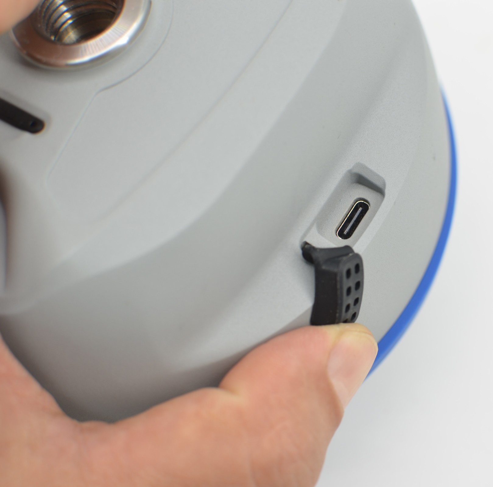
| Charge | USB PD 15V/2A, 5V/3A |
| Temperature | Operating: -25°C~+60°C / Storage: -40°C~+85°C |
| Shock Resistance | Can withstand a 1.5m drop |
| Protection Rating | IP68 |
| Materials | Magnesium alloy casing with ABS/PC top cover |
| Dimensions / Weight | 134mm*86mm / ≤0.75Kg |
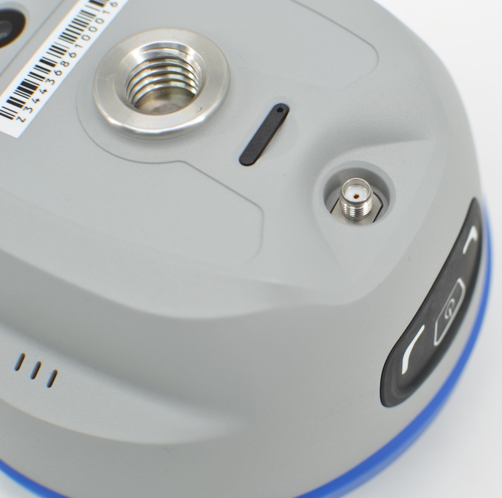
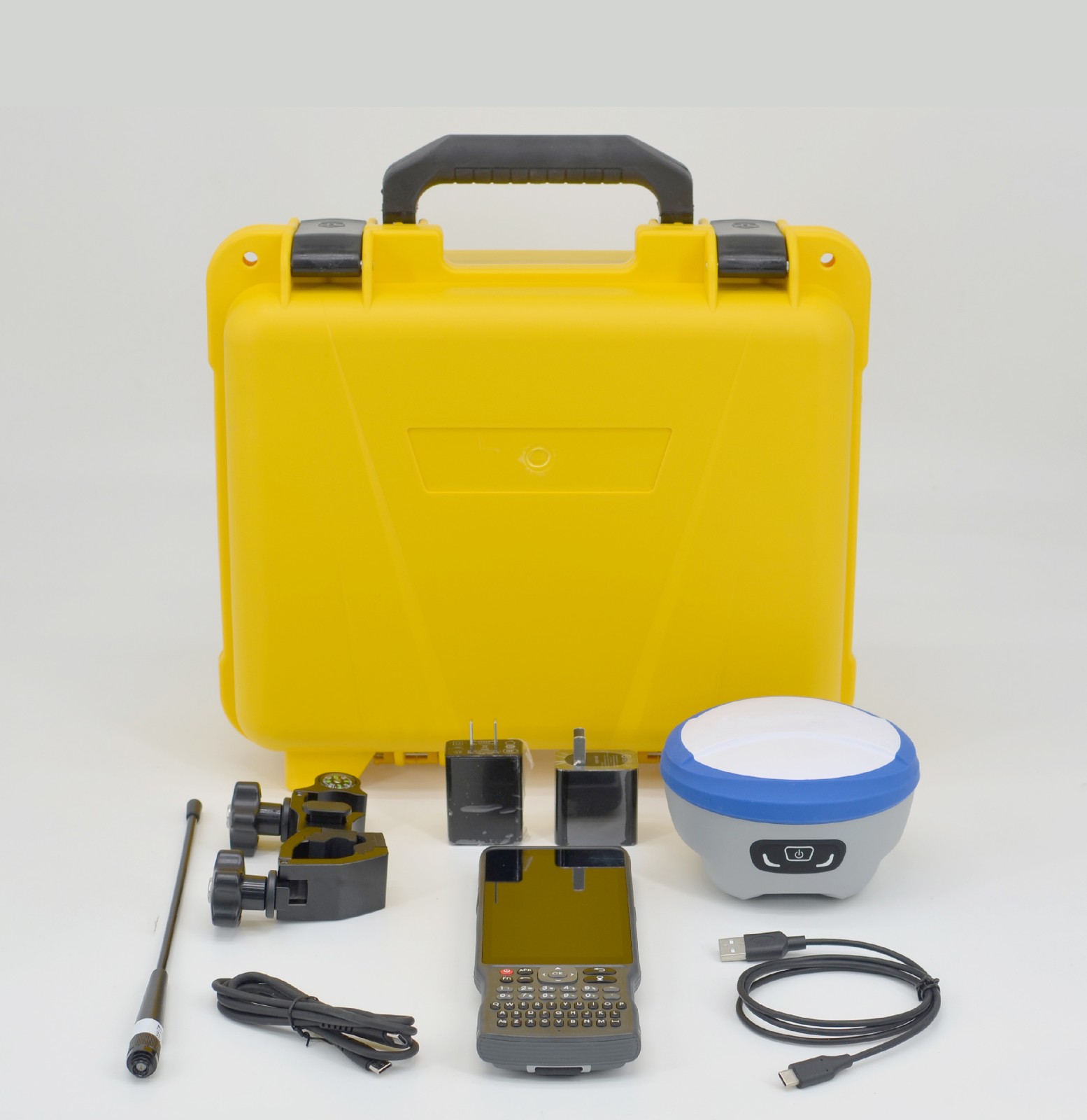
| Accessories | DG95, USB Adapter, Type-C Cable, Antenna, Controller |
The DG95 is equipped with a high-precision positioning module featuring 1408 channels, ensuring robust satellite tracking.
It supports calibration-free IMU tilt measurement with an accuracy of better than 2cm within a 60° tilt range.
Yes, the DG95 features AR real-time stakeout functionality using a built-in high-definition camera for visual guidance.


Contact our customer support
team 7×24 hours
WhatsApp:+86-+86 18915003276